


Promised Land Voting District, Craighead County, Arkansas
About
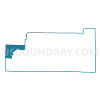
Outline

Summary
| Unique Area Identifier | 526248 |
| Name | Promised Land Voting District |
| County | Craighead County |
| State | Arkansas |
| Area (square miles) | 32.27 |
| Land Area (square miles) | 32.23 |
| Water Area (square miles) | 0.04 |
| % of Land Area | 99.87 |
| % of Water Area | 0.13 |
| Latitude of the Internal Point | 35.84051890 |
| Longtitude of the Internal Point | -90.97530880 |
Maps


Graphs
Select a template below for downloading or customizing gragh for Promised Land Voting District, Craighead County, Arkansas


Neighbors
Neighoring Voting District (by Name) Neighboring Voting District on the Map
- Big Creek Voting District, Craighead County, AR
- DOWELL Voting District, Lawrence County, AR
- Jonesboro PCT 7 North, Craighead County, AR
- Little Texas Voting District, Craighead County, AR
- MARION Voting District, Lawrence County, AR
- Swifton Voting District, Jackson County, AR
- Texas Voting District, Craighead County, AR
Top 10 Neighboring County Subdivision (by Population) Neighboring County Subdivision on the Map
- Jonesboro township, Craighead County, AR (54,649)
- Big Creek township, Craighead County, AR (5,277)
- Glass township, Jackson County, AR (1,088)
- Texas township, Craighead County, AR (390)
- Marion township, Lawrence County, AR (328)
- Dowell township, Lawrence County, AR (291)
- Little Texas township, Craighead County, AR (198)
- Promised Land township, Craighead County, AR (190)
Top 10 Neighboring Place (by Population) Neighboring Place on the Map
Top 10 Neighboring Unified School District (by Population) Neighboring Unified School District on the Map
Top 10 Neighboring State Legislative District Lower Chamber (by Population) Neighboring State Legislative District Lower Chamber on the Map
- State House District 74, AR (30,962)
- State House District 58, AR (27,318)
- State House District 73, AR (26,277)
Top 10 Neighboring State Legislative District Upper Chamber (by Population) Neighboring State Legislative District Upper Chamber on the Map
- State Senate District 14, AR (91,166)
- State Senate District 12, AR (83,956)
- State Senate District 11, AR (80,865)
Top 10 Neighboring 111th Congressional District (by Population) Neighboring 111th Congressional District on the Map
Top 10 Neighboring Census Tract (by Population) Neighboring Census Tract on the Map
- Census Tract 12, Craighead County, AR (4,835)
- Census Tract 4801, Jackson County, AR (3,490)
- Census Tract 4704, Lawrence County, AR (1,690)
Top 10 Neighboring 5-Digit ZIP Code Tabulation Area (by Population) Neighboring 5-Digit ZIP Code Tabulation Area on the Map
- 72404, AR (23,482)
- 72476, AR (7,155)
- 72416, AR (5,783)
- 72471, AR (1,108)
- 72421, AR (554)
- 72410, AR (498)
- 72427, AR (174)